TMS WebGMaps v1.5.0.1 Full Source
Дата: 19.12.2012 | Комментариев: 0 | Просмотров: 4340

Different map modes are available: default road map, satellite view, hybrid view and terrain
Extra map information can be displayed: Bicycle View, Panoramio (pictures of interest) information, Traffic information
StreetView can be selected
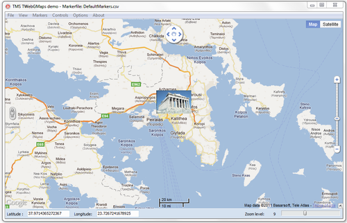
Position markers may be added to the maps, including default Google balloon markers and custom image markers.
Moving over a marker can display a hint with the marker title information
Extensive configuration options over the different Google maps controls are available: MapType control, OverViewMap control, Pan control, Scale control, StreetView control and Zoom control.
Image files can be created of the displayed map. Images can be saved in different formats: .BMP, .JPG or .PNG
Different mouse and keyboard options to enable/disable: mouse or keyboard panning, mouse or keyboard zoom, mouse wheel scrolling
TWebGMapsGeocoding helper component to facilitate conversions between address and longitude/latitude coordinates
v1.5.0.1
Fixed : Issue with use of TWebGMaps from C++Builder
v1.5.0.0
New : TWebGMapsLookupEdit control for address auto completion
New : TWebGMapsDirectionList control to show steps of direction info
New : Support to show & interact with polylines on map
New : Support to show & interact with polygons on map
New : Support to add labels for markers
New : Support for getting direcion information & showing directions
New : Functions to get & set viewports coordinates based on longitude, latitude
New : Demo showing directions, polygons, markers with labels, lookup & route list
Все используемые на сайте статьи, файлы и логотипы компаний принадлежат их законным владельцам. Если вы являетесь правообладателем "TMS WebGMaps v1.5.0.1 Full Source" и не желаете, чтобы ваша информация находилась на нашем сайте, напишите нам и эта информация будет удалена.
Категория: Delphi » Delphi-компоненты
Уважаемый посетитель, Вы зашли на сайт как незарегистрированный пользователь.
Мы рекомендуем Вам зарегистрироваться либо войти на сайт под своим именем.
Мы рекомендуем Вам зарегистрироваться либо войти на сайт под своим именем.

